Most Lake Washington paddlers know Magnuson Park. Far fewer know about the quieter access points immediately north — the stretch of shoreline along the NOAA Western Regional Center campus and the less-trafficked northern sections of the park. Same water, same conditions, significantly less competition for parking.
NOAA Beach (North Magnuson Shore)
The National Oceanic and Atmospheric Administration campus borders Magnuson Park to the north, and the waterfront along this stretch sees a fraction of the traffic that the main Magnuson launch handles. Public shoreline access runs along the park boundary adjacent to the campus.
Address: Access via the north end of Warren G. Magnuson Park — follow Sand Point Way NE north past the main park entrance, then use the north parking areas near NE 74th St.
📍 Get Directions on Google Maps
Parking: The north lot at Magnuson rarely fills even when the main south lots are packed. On summer weekends this can make the difference between a 7-minute walk to the water and a 25-minute walk from the overflow lot.
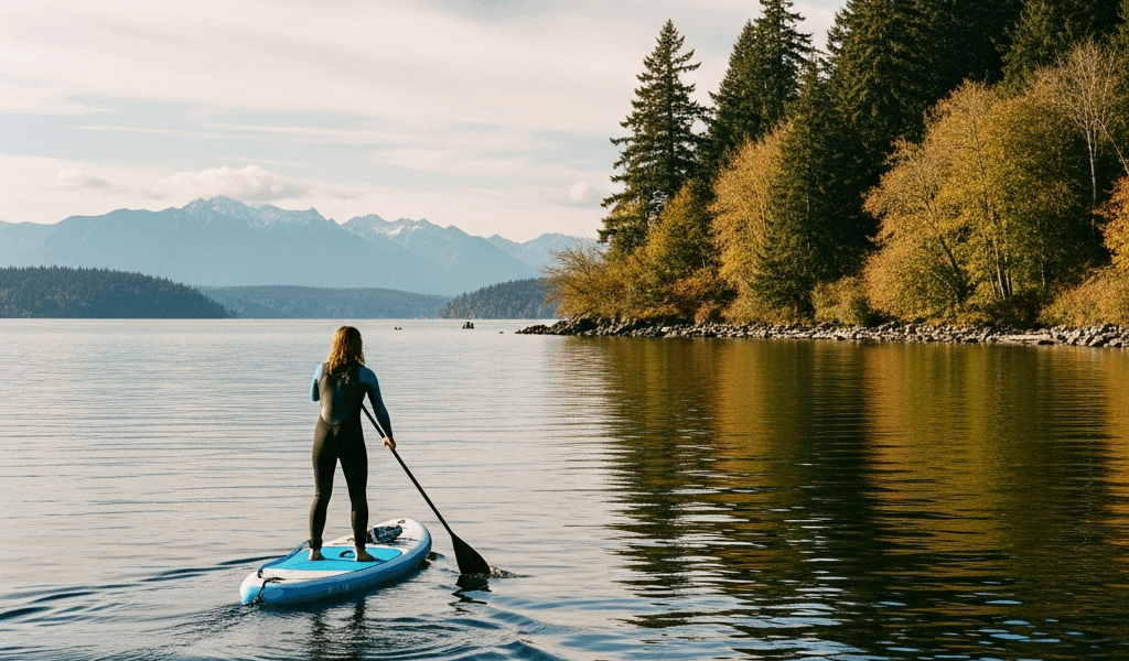
Water conditions: North Magnuson has the same lake water as the main launch — calm on most mornings, some afternoon chop from south winds. The north shore sits slightly more protected from southerly winds than the main launch area.
Best for: Paddlers who know the Magnuson area and want to skip the weekend crowd. Also useful for accessing the north lake without the Kenmore drive.
Sand Point Way — South Shore Access
The main Magnuson Park launch is the primary Sand Point access point and handles the bulk of lake traffic in this area. Even on busy days, the south end of the park by the boat launch has better parking flow than Matthews Beach further north.
Address: Warren G. Magnuson Park, 7400 Sand Point Way NE, Seattle, WA 98115
📍 Get Directions on Google Maps
Parking: Multiple lots. The main south lot by the boat ramp fills first. The overflow lots in the central park area add significant capacity — just a longer carry to the water. Weekday launches are rarely a parking issue at any Magnuson lot.
Water conditions: Protected by the sand point itself from westerly winds. Southwest wind still creates chop on open water. The bay just north of the main launch is the most sheltered section of open lake in this area.
Best for: Intermediate paddlers doing north lake routes, anyone launching for the Sand Point to Matthews Beach corridor paddle (roughly 2 miles one-way along the west shore).
The Sand Point to Matthews Beach Paddle
One of the cleaner out-and-back routes on north Lake Washington: launch from Magnuson, paddle north along the west shore past the NOAA campus, and continue to Matthews Beach Park — roughly 2 miles one way. The shoreline is mostly natural with some residential docks, and boat traffic is lighter here than on the main lake.
Returning south you get the open lake view east toward Bellevue and the Cascades. On clear days, Mount Baker is visible to the northeast from the open water section.
Practical Notes
- Boat ramp hours: Magnuson’s ramp is open from 6 AM to sunset most of the year
- Ramp fee: Motorized boats pay a launch fee; hand-carried boards and kayaks typically launch from the beach at no charge — confirm current Seattle Parks policy
- Dogs: Dogs are allowed on leash at Magnuson; an off-leash area is in the south park section
- Wind pattern: Southwest wind is the main factor here. Check forecasts before an afternoon launch — morning is reliably calmer
- Route extension: Experienced paddlers continue north past Matthews Beach to Kenmore (Log Boom Park) for a full north-lake traverse — roughly 5 miles one way

Stay in the loop
Get the latest seattle paddleboard updates delivered to your inbox.