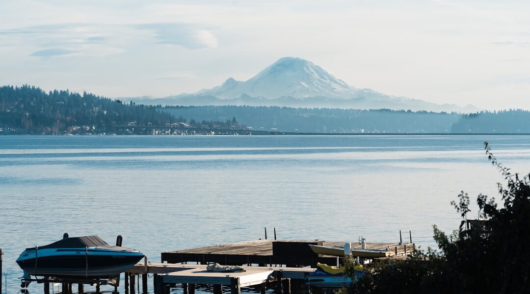
Lake Washington is 20 miles long, 1-3 miles wide, and bordered by Seattle on the west and the Eastside cities on the east. It is the backbone of Seattle-area SUP — most paddlers here launch from one of its shores, and the lake has enough variety that you could explore it for years without repeating a route.
📍 Get Directions to Magnuson Park (central west shore launch)
West Shore (Seattle Side)
The Seattle shoreline runs from the Cedar River mouth at the south end (near Renton) to Kenmore at the north. Key launches north to south: Kenmore/Log Boom Park, Matthews Beach, Magnuson/Sand Point, Madison Park Beach, Madrona Beach, Leschi Park, Seward Park, and Pritchard Beach. The west shore is hillier and the adjacent neighborhoods are more urban — parking is the main variable.
The west shore gets afternoon shadow from the Cascade-facing hills in some sections. It also catches southerly winds from the open lake. Morning launches are generally calmer and easier to park for.
East Shore (Eastside)
The east shore is flatter and more suburban. Key launches: Juanita Beach (Kirkland north), Kirkland Marina Park (downtown), Meydenbauer Beach (Bellevue), Clyde Beach, Enatai Beach. The east shore is exposed to westerly wind that moves across the lake — the same wind that makes it manageable on the Seattle side can stack up whitecaps on the Bellevue shore by afternoon.
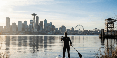
Clear-day views from the east shore west toward Seattle include the skyline, Capitol Hill, and on exceptional days the Olympics behind the city — one of the better urban paddle views in the country.
Key Routes
- I-90 Bridge passage: The floating bridge connects Seattle to Mercer Island. A gap in the bridge (the Mercer Island lid) allows passage for small watercraft. Paddle through on calm days for the surreal experience of a highway above your head and open lake on both sides.
- Mercer Island circumnavigation: About 13 miles around the island — a serious half-day to full-day route for experienced paddlers.
- Magnuson to Matthews Beach: 2 miles along the northwest shore — a clean out-and-back with good Baker views on clear days.
- Full lake length: About 20 miles one way from the Cedar River mouth to Kenmore. A multi-day or one-way-with-shuttle route for committed paddlers.

Stay in the loop
Get the latest seattle paddleboard updates delivered to your inbox.